
Ficheiro:Ice Floes off the Northeastern Tip of Urup Island, Russia.jpg
Ficheiro orixinal (4.288 × 2.848 píxeles; tamaño do ficheiro: 3,03 MB; tipo MIME: image/jpeg)
| Este ficheiro procede de Wikimedia Commons. A continuación móstrase a información da súa páxina de descrición. Commons é un repositorio libre de ficheiros multimedia. Pode contribuír alí cargando as súas imaxes. |
Resumo
| Descrición |
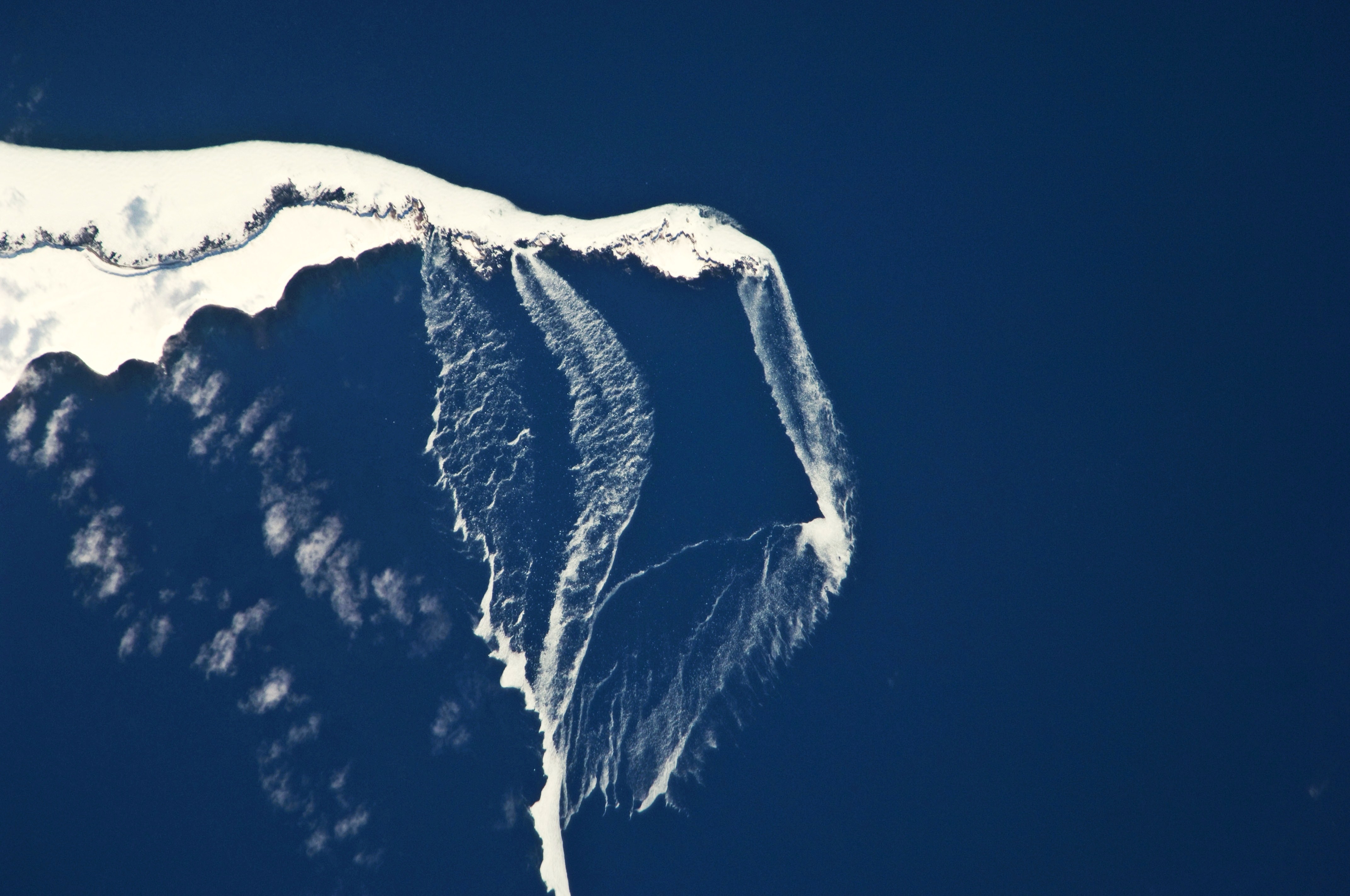
English: The north-eastern tip of the island and three small islands to the north-east are recognizable by their uniform cover of white snow and shadowing along the north-western coastlines. Sea ice that formed to the north in the Sea of Okhotsk has been piled up against the islands by prevailing north-westerly winds, forming an irregular mass connecting the islands (image centre). The orientation of patchy low clouds over Urup Island (image lower left) also suggests that north-westerly winds are present. Smaller ice floes are breaking off from the main ice mass at gaps between the islands and forming finger-like projections of ice fragments that extend to the south-east (image lower right). Surface winds may be channelled through these gaps and accelerated, hastening the breakup and movement of ice. |
| Data | |
| Orixe | NASA Earth Observatory |
| Autoría | Image captured by the NASA Expedition 23 crew |
Image acquired with a Nikon D2Xs digital camera fitted with an 800 mm lens, and is provided by the ISS Crew Earth Observations experiment and Image Science & Analysis Laboratory, Johnson Space Center. Center Point Latitude: 46.2 Center Point Longitude: 150.6 (Negative numbers indicate south for latitude and west for longitude). Camera Tilt: 13 Camera Focal Length: 800mm Camera: N2: Nikon D2Xs Film: 4288E : 4288 x 2848 pixel CMOS sensor, RGBG imager color filter. Nadir Point Latitude: 46.4, Longitude: 151.3 (Negative numbers indicate south for latitude and west for longitude) Nadir to Photo Center Direction: West Sun Azimuth: 127 (Clockwise angle in degrees from north to the sun measured at the nadir point) Spacecraft Altitude: 183 nautical miles (339 km) Sun Elevation Angle: 35 (Angle in degrees between the horizon and the sun, measured at the nadir point).
Licenza
| Este ficheiro está no dominio público porque foi creado pola NASA. A política do copyright da NASA declara que "o material da NASA non está protexido polos dereitos de autor a non ser que se indique o contrario". (Páxina de políticas do copyright da NASA ou política de uso de imaxes JPL). | ||
 |
Avisos:
|
| Anotacións | Esta imaxe ten anotacións: Olle as anotacións en Commons |
Historial do ficheiro
Prema nunha data/hora para ver o ficheiro tal e como estaba nese momento.
| Data/Hora | Miniatura | Dimensións | Usuario | Comentario | |
|---|---|---|---|---|---|
| actual | 19 de abril de 2010 ás 12:36 | | 4.288 × 2.848 (3,03 MB) | Originalwana | {{Information |Description={{en|1=The north-eastern tip of the island and three small islands to the north-east are recognizable by their uniform cover of white snow and shadowing along the north-western coastlines. [[:C |
Uso do ficheiro
A seguinte páxina usa este ficheiro:
Uso global do ficheiro
Os seguintes wikis empregan esta imaxe:
- Uso en az.wikipedia.org
- Uso en bg.wikipedia.org
- Uso en en.wikipedia.org
- Uso en it.wikipedia.org
- Uso en ru.wikipedia.org