
Ficheiro:Land Use in the Potomac Basin.gif
Tamaño desta vista previa: 800 × 598 píxeles. Outras resolucións: 320 × 239 píxeles | 640 × 479 píxeles | 900 × 673 píxeles.
Ficheiro orixinal (900 × 673 píxeles; tamaño do ficheiro: 232 kB; tipo MIME: image/gif, 0,2 s)
| Este ficheiro procede de Wikimedia Commons. A continuación móstrase a información da súa páxina de descrición. Commons é un repositorio libre de ficheiros multimedia. Pode contribuír alí cargando as súas imaxes. |
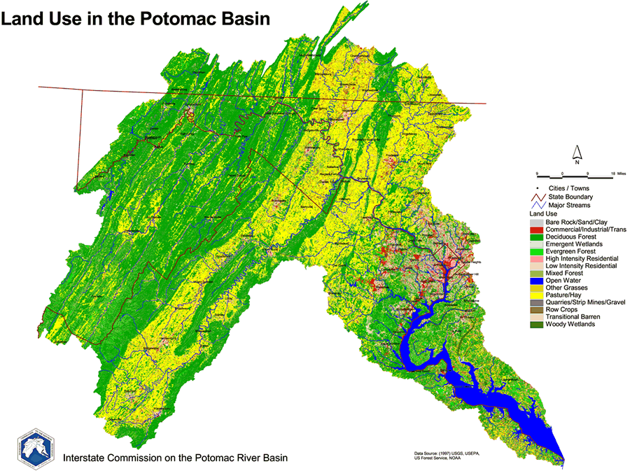
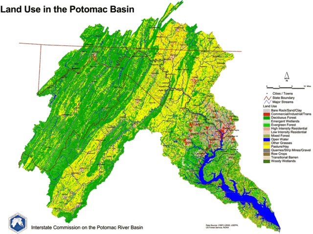
English: 1997 Land Use Map of the Potomac River Basin provided to the public domain by the U.S. Department of the Interior and the U.S. Geological Survey.
Esta imaxe está no dominio público, xa que contén materiais que orixinalmente viñeron do Servizo Xeolóxico dos Estados Unidos de América, unha axencia do Departamento do Interior dos Estados Unidos de América. Para obter máis información, consulta a política oficial de dereitos de USGS.
|
Historial do ficheiro
Prema nunha data/hora para ver o ficheiro tal e como estaba nese momento.
| Data/Hora | Miniatura | Dimensións | Usuario | Comentario | |
|---|---|---|---|---|---|
| actual | 20 de marzo de 2006 ás 19:44 | | 900 × 673 (232 kB) | West Virginian | 1997 Land Use Map of the Potomac River Basin provided to the public domain by the U.S. Department of the Interior and the U.S. Geological Survey. {{USGS}} |
Uso do ficheiro
A seguinte páxina usa este ficheiro:
Uso global do ficheiro
Os seguintes wikis empregan esta imaxe:
- Uso en ar.wikipedia.org
- Uso en azb.wikipedia.org
- Uso en de.wikipedia.org
- Uso en el.wikipedia.org
- Uso en en.wikipedia.org
- Uso en es.wikipedia.org
- Uso en ja.wikipedia.org
- Uso en ko.wikipedia.org
- Uso en la.wikipedia.org