
Ficheiro:Netherlands Zeeland location map.svg

Tamaño desta vista previa en PNG do ficheiro en formato SVG: 534 × 600 píxeles. Outras resolucións: 214 × 240 píxeles | 427 × 480 píxeles | 683 × 768 píxeles | 911 × 1.024 píxeles | 1.823 × 2.048 píxeles | 890 × 1.000 píxeles.
Ficheiro orixinal (ficheiro SVG; resolución de 890 × 1.000 píxeles; tamaño do ficheiro: 262 kB)
| Este ficheiro procede de Wikimedia Commons. A continuación móstrase a información da súa páxina de descrición. Commons é un repositorio libre de ficheiros multimedia. Pode contribuír alí cargando as súas imaxes. |
Resumo
| Descrición |
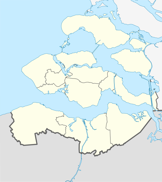
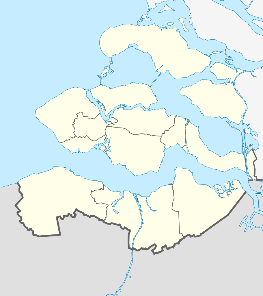
English: Location map of province Zeeland in the Netherlands
Equirectangular projection, N/S stretching 160 %. Geographic limits of the map:
Deutsch: Positionskarte von der Provinz Zeeland in den Niederlanden
Quadratische Plattkarte, N-S-Streckung 160 %. Geographische Begrenzung der Karte:
|
| Data | |
| Orixe | Obra propia |
| Autoría | Erik Frohne |

|
Este mapa foi criado ou melhorado na Kartenwerkstatt (oficina gráfica) alemã. Você também pode propor mapas para serem melhorados.
|
Licenza
Eu, como posuidor dos dereitos de autor desta obra, pola presente publícoa baixo as seguintes licenzas:

|
Autorízase a copia, distribución e/ou modificación deste documento baixo os termos da licenza de documentación libre GNU, versión 1.2 ou calquera outra que posteriormente publique a Free Software Foundation; sen seccións invariables, textos de portada, nin textos de contraportada. Inclúese unha copia da devandita licenza na sección titulada GNU Free Documentation License. |
Este ficheiro está licenciado baixo as licenzas Creative Commons recoñecemento compartir igual 3.0 Unported, recoñecemento compartir igual xenérico 2.5, recoñecemento compartir igual xenérico 2.0 e recoñecemento compartir igual xenérico 1.0.
- Vostede é libre de:
- compartir – copiar, distribuír e difundir a obra
- facer obras derivadas – adaptar a obra
- Baixo as seguintes condicións:
- recoñecemento – Debe indicar a debida atribución de autoría, fornecer unha ligazón á licenza e indicar se se realizaron cambios. Pode facer isto de calquera forma razoable, mais non nunha forma que indique que quen posúe a licenza apoia ou subscribe o seu uso da obra.
- compartir igual – Se altera, transforma ou amplía este contido, debe publicar as súas contribucións baixo a mesma licenza ou outra compatible á orixinal.
Pode seleccionar a licenza que desexe.
Historial do ficheiro
Prema nunha data/hora para ver o ficheiro tal e como estaba nese momento.
| Data/Hora | Miniatura | Dimensións | Usuario | Comentario | |
|---|---|---|---|---|---|
| actual | 28 de maio de 2009 ás 13:03 | | 890 × 1.000 (262 kB) | Erik Frohne | == Beschreibung == {{Information |Description={{en|1=Location map of province Zeeland in the Netherlands Equirectangular projection, N/S stretching 160 %. Geographic limits of the map: * N: 51.80° N * S: 51.10° N * W: 3.30° E * E: 4.30° E}} {{de|1 |
Uso do ficheiro
A seguinte páxina usa este ficheiro:
Uso global do ficheiro
Os seguintes wikis empregan esta imaxe:
- Uso en bg.wikipedia.org
- Uso en cs.wikipedia.org
- Uso en de.wikipedia.org
- Zierikzee
- Zeelandbrug
- Fernsehturm Goes
- Zuid-Beveland
- Wikipedia:Kartenwerkstatt/Positionskarten/Europa
- Zandenburg
- Vorlage:Positionskarte Niederlande Zeeland
- Krijn
- Dreiband-Weltcup 2009/1
- Leuchtturm Westerlichttoren
- Leuchtturm Westkapelle (Unterfeuer)
- Tholen (Insel)
- Leuchtturm Nieuwe Sluis
- Dreiband-Weltcup 2005/1
- Dreiband-Weltcup 2006/1
- Dreiband-Weltcup 2007/1
- Dreiband-Weltcup 2008/1
- Brug Sas van Gent
- Sluiskilbrug
- Manteling van Walcheren
- Drehbrücke Souburg
- Uso en de.wikivoyage.org
- Uso en eo.wikipedia.org
- Uso en es.wikipedia.org
- Uso en frr.wikipedia.org
- Uso en fr.wikipedia.org
Ollar o uso global deste ficheiro.